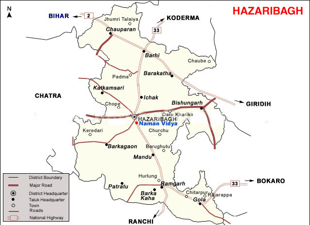
Description:Hazaribagh literally means a place with thousand gardens. The British had built the picturesque town of Hazar Bag or Hazaribag at a height of 615m on the plateau of Chhotonagpur. Grey hills stand guard over the whole area. It has a reputation of being a healthy place. Therefore, the health seekers come here more than the tourists. The natural beauty of Hazaribag National Park is undeniably very attractive. Hazaribaghs location is approximately three hundred and twenty kilometers west of Calcutta. The principal centre of administration is Hazaribagh town, which is situated at the highest point of the plateau at 2,000 feet altitude .
How To Get There :
By Air
The nearest airport, Ranchi (91 kms) is connected with Kolkata, Patna, Lucknow and Delhi by regular Indian Airlines service.
By Rail
The nearest railway station is Koderma which is 59 kms away or alternately one can apporach the National Park from Hazaribagh Road railway station (67 kms) on the Howrah- Delhi Grand Chord line.
By Road
Hazaribagh town is connected by road to Ranchi 91 kms, Dhanbad 128 kms,Gaya 130 kms, Patna 235 kms, Daltonganj 198 kms, Kolkata (via Asansol-Govindapur-Barhi) 434 kms.
By Bus
Regular bus services connect the town with Koderma, Hazaribagh Road rly station,Patna, Gaya, Ranchi, Dhanbad, Dalotongunj, Kolkata and other nearby places.
( Hazaribagh Map ) |